GIS Applications
GEOG 176C, Spring 10, 5 credits
Instructor: Dr. Martin Raubal, raubal@geog.ucsb.edu
Office (hours): Wednesday 3-4:30pm, EH 5713
Phone: 893-4839
Teaching Assistants:
Yihong Yuan, yuan@geog.ucsb.edu, Tuesday 10am-12pm, 5807 Ellison Hall;
Edward Pultar, pultar@geog.ucsb.edu, by appointment, 5807 Ellison Hall;
Class meets:
Lectures – T, Th 2-3:15pm , LSB (Life Sciences Building) 1001
Lab 1 (Edward) – Mon 5pm – 7:50pm, 2610 Ellison Hall, aka the Star lab
Lab 2 (Yihong) – Thu 5pm – 7:50pm, 2610 Ellison Hall, aka the Star lab
Lab 3 (Edward/Yihong) – Fri 10am – 12:50pm, 2610 Ellison Hall, aka the Star lab
Course description:
Applying GIS theory and techniques to solve spatial problems in various domains, such as land and resource management, emergency management, utilities, and municipal government. Lectures cover all stages of a GIS project, e.g., planning, design, analysis, and presentation of results. In labs, students collaborate in groups to design, develop, and present a GIS pilot study.
Prerequisites and recommended preparation:
Prereq: Geography 176B with a minimum grade of C; recommended: GEOG12 Maps and Mapping
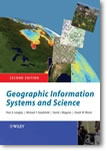
Required Textbook: Longley, P.A., M.F. Goodchild, D.J. Maguire, and D.W. Rhind, 2005. Geographic Information Systems and Science. Second Edition. New York: Wiley.
http://www.wiley.com/legacy/wileychi/longley/
It is required that students buy their own copy of this book.
Weekly readings are listed below. Please come to class prepared to discuss the readings, which are listed for that day.
Course Website: http://www.geog.ucsb.edu/~raubal/Courses/geog176c/index.htm
Required Media: You must have a USB flash drive for the lab. You will be working between several different workstations. Flash drives enable you to easily transfer your work between workstations and to back up your work.
Evaluation (Project requirements and due dates , project groups):
- Project proposal and presentation (group): 20%
- Lab participation (individual): 25%
- Final presentation (group): 20%
- Final report (report guidelines) (group): 20%
- Poster (group): 15%
|

|
Course Policies: Attendance is required for both the lecture and the labs. It is crucial for students to attend the full lab period to get the necessary exposure with the topic, the technology, and to stay on target on the project. Your TA will provide theoretical and technical help that will aid you in completing the project work.
There are exact due dates for deliverables. Lateness will cost you 20% each day. This rule is not flexible. Please inform us in advance if you will miss a lab meeting or will have a personal situation that will affect your attendance or performance.
Academic conduct: http://www.catalog.ucsb.edu/current/general/app.htm
Date |
|
Lecture topic |
Reading |
|
|
|
|
Week 1 |
Mar 30 |
Introduction, project topics, expectations (lecture slides; project ideas) |
|
|
Apr 1 |
Seetha Raghupathy & Kim Yasuda, Participatory Planning Towards Placemaking: A Community Arts and Design Collaborative in Isla Vista (IV planning summary) |
|
|
|
|
|
Week 2 |
Apr 6 |
GIS project lifecycle (lecture slides) |
|
|
Apr 8 |
Paul Bartsch & Jerome Ripley, UCSB Design & Construction Services (lecture slides) |
|
|
|
|
|
Week 3 |
Apr 13 |
Managing GIS (lecture slides) |
Chapters 17, 18 |
|
Apr 15 |
Legal issues, GIS assets & constraints (lectures slides) |
Chapters 19 |
|
|
|
|
Week 4 |
Apr 20 |
GIS applications (Edward, lecture slides EDGIS & GEDMWA) |
|
|
Apr 22 |
Work session (TAs) |
|
|
|
|
|
Week 5 |
Apr 27 |
Project proposal presentations (Lab Edward) |
|
|
Apr 29 |
Project proposal presentations (Lab Yihong) |
|
|
|
|
|
Week 6 |
May 4 |
Navteq presentations (Wei Yeh Lee & Adam Grabowski) |
|
|
May 6 |
Developments in Location Based Services (lecture slides) |
|
|
|
|
|
Week 7 |
May 11 |
Work session (TAs) |
|
|
May 13 |
Work session (TAs) |
|
|
|
|
|
Week 8 |
May 18 |
LBS, GIS assets cont. |
|
|
May 20 |
GIS partnerships |
Chapter 20 |
|
|
|
|
Week 9 |
May 25 |
Work session |
|
|
May 27 |
Work session |
|
|
|
|
|
Week 10 |
Jun 1 |
Poster presentations (CIRGIS meeting) |
|
|
Jun 3 |
Work session |
|
|
|
|
|
Week 11 |
Jun 8, 4-7pm |
Project presentations |
|
Links:
Projects on Geography ArcGIS Server:
Isla Vista:
Bibliography:
- P. Longley, M. Goodchild, D. Maguire, and D. Rhind (2005) Geographic Information Systems and Science. John Wiley and Sons, Chichester, England.
- T. Bernhardsen (1999) Choosing a GIS. in: P. Longley, M. Goodchild, D. Maguire, and D. Rhind (Ed.), Geographical Information Systems, Volume 2: Management Issues and Applications. 2, pp. 589-600, Wiley, New York.
